


Thứ sáu, 25/09/2026 | 21:29


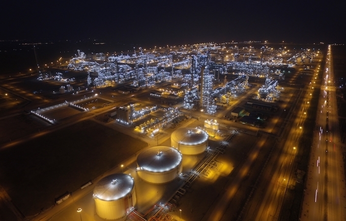
Analysing the spatial distribution of land surface temperature at Nghi Son refinery and petrochemical complex using Landsat and Sentinel 2 satellite image data Trinh Le Hung Military Technical Academy Email: trinhlehung@lqdtu.edu.vn Summary: The Landsat 5, Landsat 8 and Sentinel 2A satellite image data are used for extracting land surface temperature, thereby mapping the spatial distribution of land surface temperature at Nghi Son Refinery and Petrochemical Complex. The obtained results then can be used in monitoring land surface temperature changes, for land use planning as well as in minimising the impact of production processes to the environment. Key words: Land surface temperature, thermal infrared remote sensing, Nghi Son Refinery and Petrochemical Complex |

Thay mặt Chính phủ, Phó Thủ tướng Hồ Quốc Dũng ký Nghị quyết số 282/NQ-CP ngày 22/9/2026 ban hành Kế hoạch hành động của Chính phủ thực hiện Kết luận số 51-KL/TW ngày 17/6/2026 của Bộ Chính trị về đẩy mạnh công tác sở hữu trí tuệ phục vụ phát triển kinh tế - xã hội trong tình hình mới.
24/09/2026
Thay mặt Chính phủ, Phó Thủ tướng Hồ Quốc Dũng ký Nghị quyết số 282/NQ-CP ngày 22/9/2026 ban hành Kế hoạch hành động của Chính phủ thực hiện Kết luận số 51-KL/TW ngày 17/6/2026 của Bộ Chính trị về đẩy mạnh công tác sở hữu trí tuệ phục vụ phát triển kinh tế - xã hội trong tình hình mới.
24/09/2026